
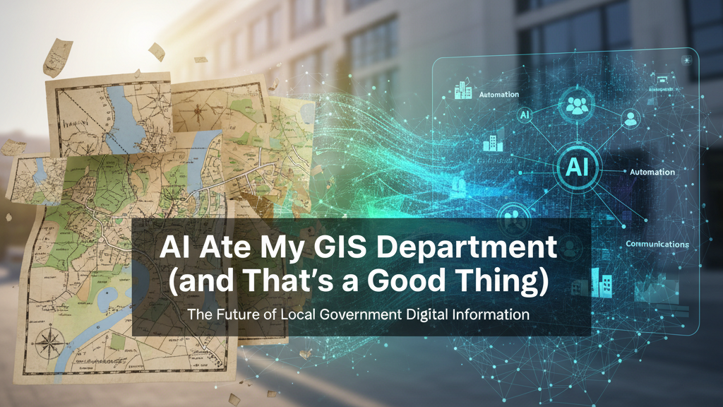
From GIS Director to Digital Information Director: Why I Made the Leap
About two years ago, I started to suspect that the traditional GIS department model wasn’t built for where local government was heading.
At the time, I was the GIS Director for a small rural county. My world was maps, parcels, and layers, neatly stacked, carefully maintained, and quietly brilliant. But the more I looked around, the more I realized: GIS alone wasn’t enough anymore.
Technology was moving faster than our org charts. AI, automation, analytics, and communications were starting to blur together. To solve real local problems like staff shortages, response delays, or siloed data, we needed to think bigger. I talked a lot about this in my recent article, The GIS Department is Dead. Long Live Digital Innovation.
So instead of defending the GIS silo, I started dismantling it to build something broader.
That shift became the foundation for what is now our Digital Information Department (DID), officially just over a year old, but already reshaping how we work.
1. AI Is My Partner, Not My Replacement
I’m not a data warehousing expert, or an automation engineer, or a communications strategist, and that’s fine.
AI is teaching me as I go.
It’s showing us why Postgres and PostGIS matter far beyond mapping. It’s helping us connect systems so data can serve AI, analytics, GIS, and communications all at once. It’s even reframed how we see our county website, not as a PR tool, but as a critical part of the infrastructure.
We’re learning in real time. AI isn’t replacing expertise; it’s accelerating it.
2. From Maps to Momentum: Automating Entire Workflows
We started with GIS automation: streamlining map updates, parcel joins, and data validation.
Now, that same approach is transforming other processes: dog licensing, FOIA requests, tax address changes, HR forms.
Each time we apply the model, we uncover another connection point, another place where GIS thinking, automation, and AI together can solve real problems.
This isn’t theory. It’s daily work in progress.
3. We Don’t Pitch. We Prototype.
We avoid pitching a grand ‘digital strategy.’ Instead, we build small, visible wins…simple automations that save time, dashboards that answer questions, workflows that run without emails flying everywhere.
Those prototypes show what’s possible far better than any slide deck could. They’re the quiet proof points that build credibility and momentum.
4. We’re Bringing People Along
This isn’t a one-person effort.
We’ve started short demos, shared experiments, and low-pressure learning sessions across departments. Curiosity spreads quickly once people see AI doing something useful instead of theoretical.
Now we’ve formed an AI Task Force with representatives from every department. Together, we’re learning, testing, and applying AI to real work, one workflow at a time.
The magic is that it no longer feels like my initiative. It’s becoming our strategy.
5. GIS Didn’t Die. It’s Evolving.
The GIS Department, as a standalone box, no longer exists.
But the work? It’s thriving, now embedded within a broader digital framework that includes AI, automation, analytics, and communications.
We still map parcels and maintain data, but the purpose is expanding. GIS isn’t the ceiling anymore. It’s the floor we’re building from.
6. We’re Growing Through Collaboration
We’ve partnered with university fellows and researchers to help us assess what’s working and where to improve. That external perspective keeps us honest and grounded.
But I soon realized that a small rural county can’t do this alone. There’s only so much you can automate, analyze, or optimize before you run into the limits of staff capabilites, capacity, budgets, and bandwidth.
Our challenges, limited IT support, aging systems, and the eternal “do more with less” mandate, aren’t unique. Every county around us was wrestling with the same constraints, just in different zip codes.
So the real leap came when we decided to stop solving these problems in isolation and started DICE: the Digital Innovation Collaborative Exchange.
DICE is a regional partnership built on a simple premise: if we share what works, we all move faster.
Together, we’re pooling tools, data models, and AI workflows. We’re trading solutions instead of duplicating effort. We’re even coordinating training and shared support, because it turns out one regional data fellow is far more useful than five overworked generalists.
We’re building a Regional Digital Public Utility.
For a small rural county, collaboration is our scalability strategy. It’s how we build capacity without building bureaucracy, and how innovation stops being a side project and becomes shared infrastructure.
And We’re Just Getting Started
This isn’t a finished story, it’s the first chapter. The department is just over a year old. The tools are still evolving. The strategy is still maturing.
But the direction is clear: GIS isn’t fading, it’s transforming into the backbone of something much larger. And AI? It’s not a threat to what we do.
It’s the guide showing us how to do it better.
Key Takeaway: If you’re in local government GIS today, you’re perfectly placed to lead this evolution. Start small. Prototype fast. Bring others with you. Let AI help you build the department you were meant to lead.
What do you think? Am I crazy or on to something?